Halia.
From fragmented public data
to a clearer picture of risk.
From a scattered picture
to a working product.
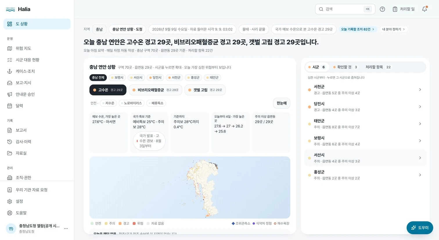
Coastal teams need to understand what is happening, where it matters, and what information supports a response. The relevant data is spread across public agencies, with different formats, timing, and meanings.
I took Halia from that problem into product planning and implementation: connecting public data, local map context, supporting evidence, and AI-assisted report drafts. My responsibilities also include presenting the product and explaining its business model.
The product earned the Grand Prize in Chungnam’s Public Data & AI Startup Competition. Development continues, with an emphasis on making the information useful in local workflows.
Where my fields
meet.
Halia draws on three parts of my background.
- 01Science
Biochemistry
Several hazards Halia tracks are biological: Vibrio bacteria that multiply in warm seawater, shellfish toxins, and norovirus. My biochemistry background gives me a working vocabulary for what those signals mean.
- 02Technology
Information Technology Convergence
Halia’s data integration, maps, and AI-assisted reporting sit in the field I’m now studying: bringing information technology into another domain.
- 03Business
Dimo
Running a business is why I ask who will use a product and how it gets adopted—questions the Halia presentation had to answer, down to its business model.
From source to screen.
A high-level view of the product I’m building.
- 01
Collect
Public APIs
Observation files
Official notices - 02
Make consistent
Formats & timestamps
Missing data
Source provenance - 03
Add context
Marine areas
Local jurisdictions
Data interpretation - 04
Make useful
Maps & summaries
Supporting evidence
Reporting workflows
Python & FastAPI · DuckDB · Next.js & TypeScript · Supabase
A product shaped
around the decision.
Three connected parts of the same project.
Keep the meaning with the data.
An observation, a model estimate, and an official warning answer different questions. A missing value is a separate state. My work connects the records while preserving those distinctions, their sources, and their timestamps.
The product needs to make those differences understandable to the person using it, as well as consistent within the underlying system.
Connect the map to someone’s work.
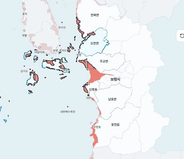
Marine areas and administrative boundaries do not line up neatly. Halia connects spatial information to the local areas people are responsible for, so they can move from a regional overview to relevant evidence.
The aim is a useful path from “what is happening” to “what matters in my area.”
Make the draft easy to question.
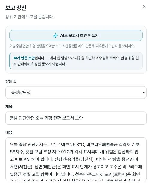
The report interface labels generated text as an AI draft and asks the person preparing it to check and edit the content. The workflow carries the supporting context alongside the result.
I built the reporting experience around that review step: the draft provides a starting point, while the person preparing the report can inspect the context and edit the text.
Grand
Prize.
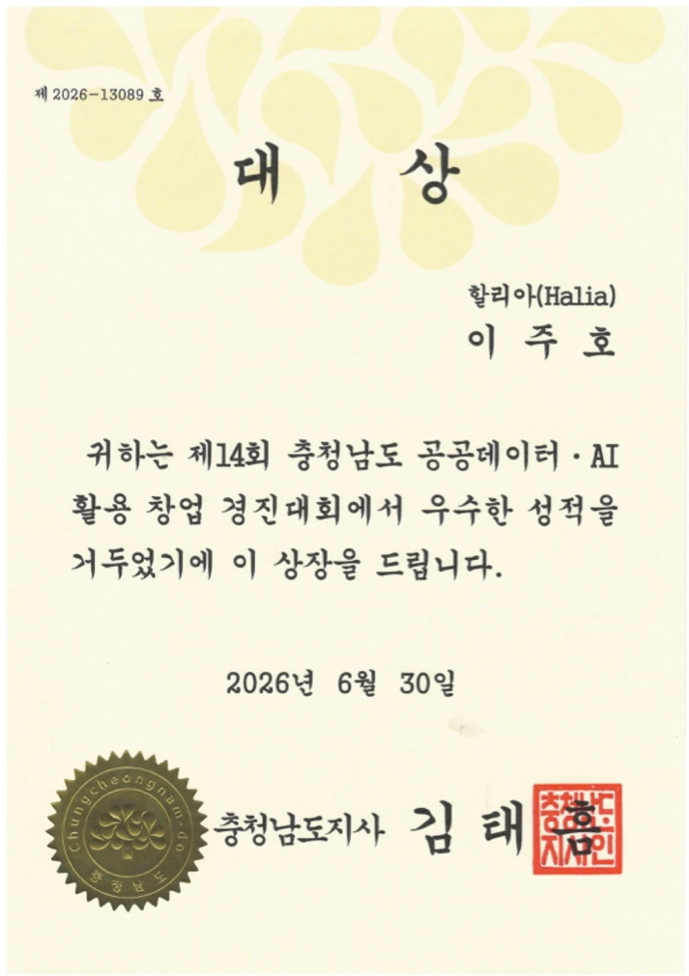
Halia won the Grand Prize—the top award in the Product & Service Development category—at the 2026 Chungnam Public Data & AI Startup Competition, and was selected to represent Chungnam in Korea’s national public-data startup competition.
- Award
- Grand Prize, top award in category
- Competition
- 14th edition, 2026
- Certificate issued by
- Governor of Chungcheongnam-do
- Next stage
- National round in progress
Build the product.
Make the case for it.
Building Halia also means explaining the problem, the intended users, and a practical route to adoption. In September 2026, I brought that work into an 18-slide competition presentation covering the product, supporting evidence, and proposed business model.
Alongside the presentation, I prepared technical documentation for patent review, separating measured evidence, theoretical reasoning, and design choices.
Technical documentation for patent review · September 2026.
Something worth
building?
Tell me what you want to build,
automate, or understand better.